 by Diptendra Raychaudhuri
New Delhi: The year 2100 is still 79 years away. Too far? Think of the children around you. Many of them will be alive then. But what will be the shape of India in those days when they will grow old?
By then sea water will rise enough to inundate, if a prediction of NASA comes true, entire southern part of Bengal (along with Bangladesh), and the water will come up to Khidirpur, the dock area of Kolkata port, which is about hundred kilometres north of Sagar island where Gangasagar Mela is held every year.
Though Bengal is the most vulnerable to rising sea water related devastations, other coastal areas of India too will face a sort of debacle. Paradwip of Odisha, Visakhapatnam of Andhra, Chennai and Tutikorin of Tamil Nadu, Kochi of Kerala, Mengaluru of Karnataka, Marmagaon of Goa, Mumbai of Maharashtra, and Bhavnagar and Kandla of Gujarat will go under water. In other words, the entire coastline will be devoured by the sea. The water in these places may not cover a hundred kilometres like in Bengal, but at least ten kilometres in safer areas and more in other parts of the coast.
Nasa’s projection is based on Intergovernment Panel of Climate Change (IPCC) that has released a 4,000-page document on data to describe what is happening to the Earth climate, and what the future will be like. Apart from rise of sea water, it has also predicted more intense and frequent heat-waves, and prolonged droughts on one hand, and on the other melting of glaciers and increased incidents of extreme rainfall. It says in another 20 years global temperature may go up by 1.5 degrees, thus touching the threshold of danger limit identified by Paris climate meet.
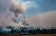
Are we not seeing the beginning of the doom now? Consider these examples: After the cyclone earlier this year, a vast area of South 24 Parganas and adjacent areas in Bengal got flooded by sea water coming through various channels; in recent days landslides have been reported from various states including Maharashtra; the US and Canada suffered tremendous heat wave this year while Germany and China experienced devastating floods, and almost unprecedented wildfire ravaged Siberia, Turkey and Greece.
Let us set aside the world, and concentrate on India. What will be the impact of such changes that has already showed first signs of setting in over the decades? Well, if the Monsoon goes erratic as has been predicted, and along with that heat waves and droughts burn a large part while another swathe of land is flooded due to sudden heavy downpours and rivers carrying more water due to melting of glaciers, it is easy guess that agricultural production will take a major hit. That will cause food scarcity in the country were the population is still growing fast now, and is expected to slow down in a significant way only after a few decades.
We have not seen any major governmental intervention, either by the centre, or by the states, to fight the crisis.
Bengal will be the most affected state in India as the hungry tides of the rising sea have already started laying claims on the land of southern Bengal. A report by the National Centre for Coastal Research (NCCR), Ministry of Earth Sciences, said that West Bengal has recorded the maximum coastal erosion of 63 per cent. Comparatively, it is only 45 per cent for Kerala, and 41 per cent for Tamil Nadu. The level of coastal erosion is lower for the other coastal states
The impact is evident in bear eyes also. Thirty years ago, the coastal tourist town of Digha had a stretch of natural beach. That is gone now, and the town, like other coastal attractions of Bengal, survive thanks to boulders and guard walls built along the coastline. On the nights of bhara kotal (extreme high tide) that appears twice a month, the sea breaches this guard wall, pushing the water into the land even up to a couple of kilometres at places. During Cyclone Yaas the water inundates a vast area of the coast.
Come to the Sunderbans. Now, during the low tide, the sea water recedes from most of the area covered by Mangrove jungles. But a few decades later, a vast area of the forest, which has shrunk to about 5 thousand square kilometres, will remain perennially inundated. The Bengal Tiger will go extinct, and as the salinity of nearby areas will increase, the mangrove forest will start advancing northwards (both in India and Bangladesh). Consequently, a vast region to the north of the Sunderbans will lay waste as the soil will have a level of salinity that would allow only mangrove trees to grow.
According to research organisations that has conducted studies on salinity in the rivers of south Bengal, and the list includes the Central Pollution Control Board, Central Inland Capture Fisheries Research Institute, Jadavpur University’s Oceanographic Studies and the Department of Urban Welfare of the state government, the salinity level has increased even 150 km upstream of the estuary. The salinity level at Uluberia, a town on the west bank of the Ganga and 110 km north of the Sagar Island, has increased from 0.028 ppt in 1985 to 0.132 ppt in 2013. It is increasing day by day, and mangrove trees have been noticed along the banks of Ganga up to Kolkata, which is hundred kilometres north of the sea.
All these are grim reminders of the fact that we are walking towards a catastrophe. The fight against global warming is of course global, but India too needs to agree to a net-zero target (i.e. bring down its emission to a level that can be absorbed by its forests and other carbon sinks). The successive governments have argued that it is not possible to do so as it will slow down the process of industrialisation, consequentially damaging the goal of poverty alleviation. While this is true, it is also true that environmental disaster too will affect in future millions and millions of lives.
It is also time to make state governments aware of the situation, particularly West Bengal. Otherwise we will lose most important years of climate-proofing to adopt us with the situation. – India News Stream

Indian legal system badly in need of fixing: CJI
Hyderabad: Chief Justice of India B.R. Gavai on Saturday said that the Indian legal system has been facing unique challenges and is badly in need of fixing. Delivering the convocation...

Air India Ahmedabad crash: Key findings from AAIB preliminary report
New Delhi: While the final report will take about an year, the preliminary findings by the Aircraft Accident Investigation Bureau (AAIB) into the fatal crash of Air India flight AI...

UK faces third, more extensive heatwave
London: The United Kingdom is bracing for its third heatwave of the year, with exceptionally hot and dry weather conditions prevailing in large parts of the country. According to the...
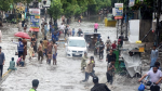
Pakistan: 98 killed, 185 injured as monsoon rains wreak havoc
Islamabad: Torrential monsoon rains and flash floods have claimed at least 98 lives and left 185 others injured across Pakistan since June 26, the National Disaster Management Authority (NDMA) said...

We missed no targets in Pak, not even a glass pane broken in India: NSA Doval on Op Sindoor
New Delhi: National Security Advisor (NSA) Ajit Doval on Friday addressed the convocation ceremony at IIT Madras, delivering a fiery defence of ‘Operation Sindoor’, India’s cross-border air assault on Pakistan...

Trump to impose 35 per cent tariff on Canada, starting August 1
Washington: US President Donald Trump announced that a 35 per cent tariff will be placed on all imports from Canada beginning August 1, citing what he described as Canada's failure...
SIR issue goes at the very roots of democracy, remarks SC
New Delhi: The Supreme Court on Thursday orally observed that the clutch of petitions challenging the Election Commission of India’s (ECI) decision to revise electoral rolls in poll-bound Bihar raises...

Trump threatens Brazil with 50 per cent tariff, seeks ex-President Jair Bolsonaro’s trial end
Washington: US President Donald Trump has said he was planning to impose a 50 per cent tax on goods made in Brazil, escalating his fight with the South American country....

Tharoor terms Emergency a dark chapter in country’s history, says ‘India of today is not that of 1975’
New Delhi: Senior Congress leader Shashi Tharoor on Thursday called 1975 Emergency a dark chapter in India’s history and added that this should serve as a reminder for everyone and...

Bihar Bandh brings state to halt, opposition calls revision ‘Vote Bandi’
Patna: Bihar Bandh by the INDIA Bloc against the Special Intensive Revision (SIR) of the voter list being conducted by the Election Commission brought the state to a grinding halt,...

Nationwide strike by trade unions in protest against Centre’s ‘anti-labour’ policies
New Delhi: A nationwide strike is underway on Wednesday, following a call by ten trade unions to protest against the Centre's alleged "anti-worker, anti-farmer, and pro-corporate" labour policies. The general...

Bihar Bandh: Rahul Gandhi, Tejashwi lead protest march; road, rail traffic hit across state
Patna: The Bihar Bandh called by the Grand Alliance (Mahagathbandhan) -- comprising the Congress, RJD, and Left parties -- against the Election Commission's Special Intensive Voter List Revision (SIR) witnessed...